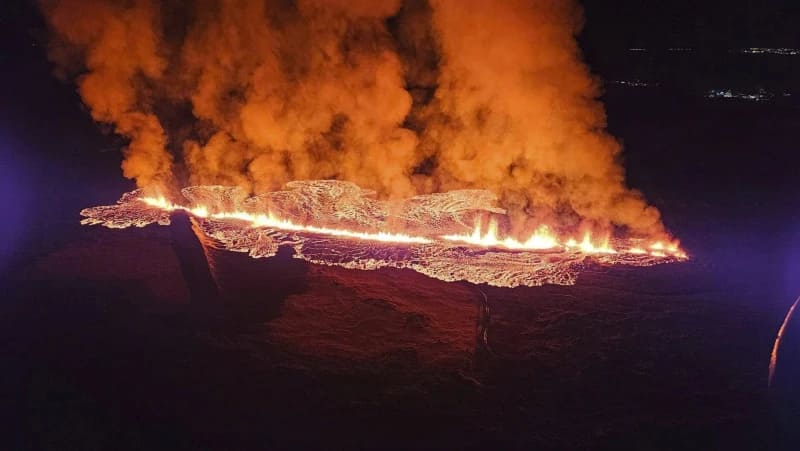
Important seismic and volcanic activity struck the area around the city of Grindavík at the end of the year 2023. A volcanic cycle began in early 2020 around this locality, located on the Mid-Atlantic Ridge, with magma movements below the surface and the formation of a graben.
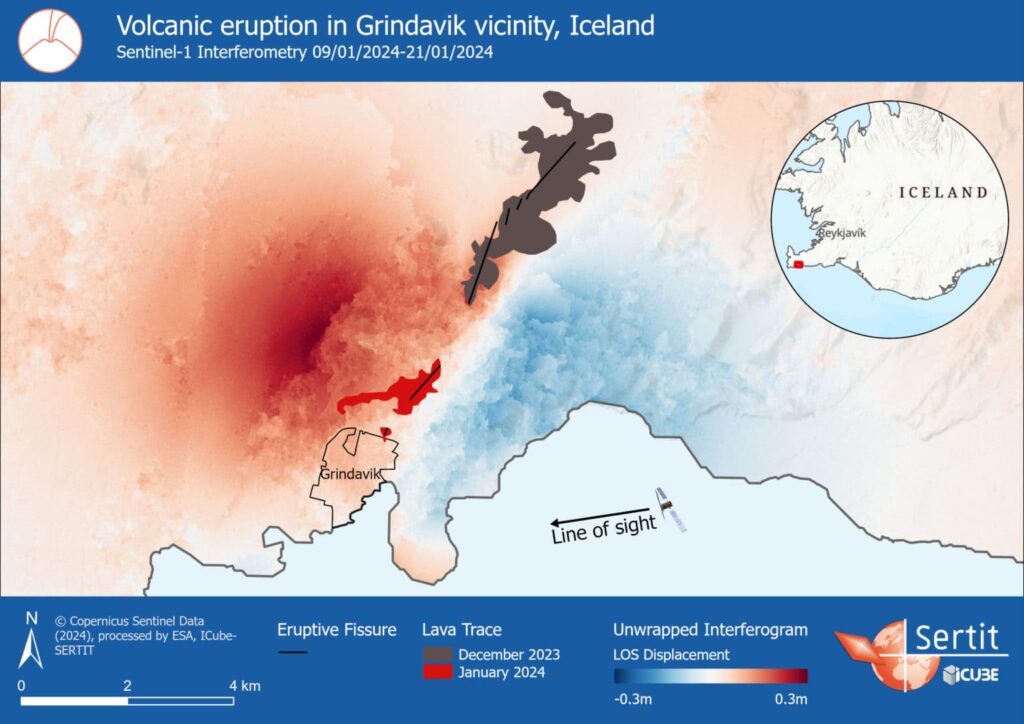
In particular, significant tectonic activity and ground movements began in November 2023, causing the evacuation of the town of Grindavík and the temporary closure of the famous Blue Lagoon south of the Reykjanes peninsula, at the south-western tip of Iceland. On December 18, after more than a month of unrest in the area, a fissure opened and the magma accumulated beneath the surface blew into a curtain of fire several kilometers long (see the trace of the December lava flow and the corresponding fissure on the map).

On January 14, 2024, after a new phase of magma accumulation, two new fissures opened, one of them in the immediate vicinity of Grindavík.
The following map shows the two lava flows (December 2023 and January 2024) with their associated fissures, as well as the displacement of the terrain in the satellite’s Line of Sight (LOS) between January 9 and 21 of 2024. SERTIT calculates this displacement by « unwrapping » an interferogram formed from two radar satellite images – here from the Sentinel-1 constellation, taken of the same location on different moments.
An uplift of the terrain up to 30cm linked to the magma accumulation to the north-west of Grindavík, as well as subsidence up to 20cm on the other side of the cracks can be observed.

The ground continues to rise to the west of the city, according to the Icelandic Meteorological Office, suggesting a new phase of magma accumulation is underway.

