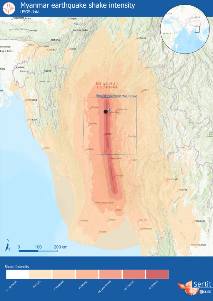
At 6:20 UTC on March 28, 2025, a major earthquake struck Myanmar (Burma), between the regions of Sagaing and Mandalay. Its magnitude ranged from 7.7 to 7.9 (on the moment magnitude scale) and was felt across a large part of the country, as well as in several neighboring countries. As of April 5, the provisional death toll had exceeded 3,300, with 4,500 injured and 220 missing in Myanmar (Burma) alone.
Tectonic Setting
The earthquake’s hypocenter is located within the Sagaing fault system, where a dextral strike-slip movement takes place, associated with the northward slip of the Indian plate in relation to the Eurasian plate: the displacement is therefore mainly along a north-south axis.
The rupture that triggered the earthquake on 28/03 is estimated to have lasted around 90 seconds.
Satellite imagery analysis
Sentinel-1 satellite was able to take an image of the area affected by the earthquake on April 4, 2025. By comparing this image to one taken before the event, an interferometric product can be computed. This product can then be used to measure the relative movements between the two dates, in the satellite’s line of sight. Sentinel-1 was on an ascending pass and operates in “right-looking” geometry. In this configuration, the satellite’s line-of-sight is oriented east-northeast, and thus the measured displacements are a projection of the actual 3D motion in this direction.
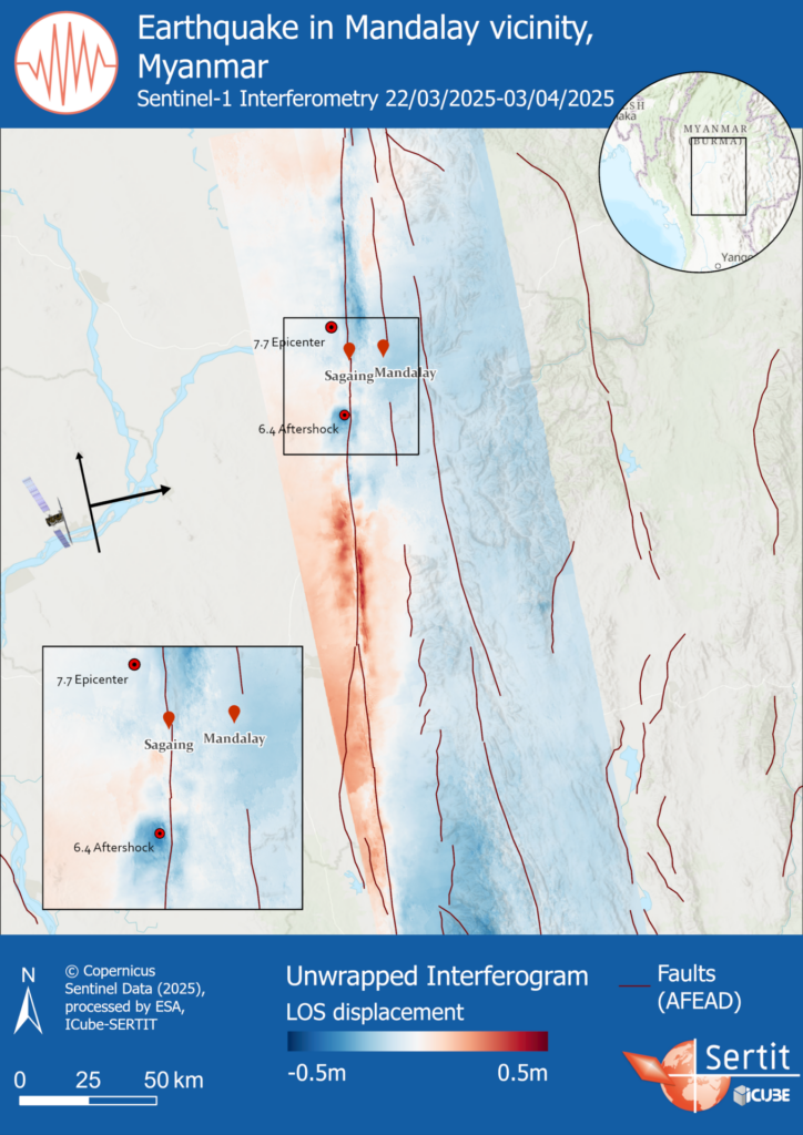
On the map, positive values correspond to displacements towards the satellite (east-north-east or uplift), while negative values indicate displacements away from the satellite (west-south-west or subsidence). The ground movement associated with this event is mainly along the north-south axis (along the fault), so Sentinel-1 here only observes the “secondary” movements that have taken place. So, although there is a slight trend on either side of the fault – probably picked up by S1 due to the slight south-north component of its line of sight – there is also local deformation, for example around the aftershock south of Sagaing.