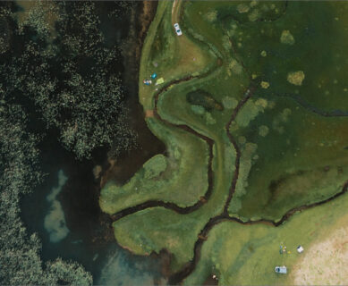
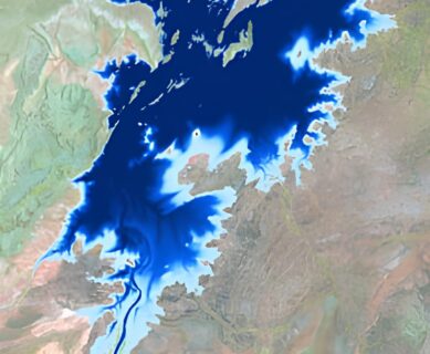
• en
  • fr
  • Sertit

    Les Non classé du Sertit 

    Location of the gravel pit of Nordhouse (Grand-Est, France)

    Case study: water surface time series of a gravel pit

    In the frame of the study of the dynamics of water bodies in the Grand-Est region (France), the water surface time series for the gravel pit in Nordhouse (next to the Plan d’Eau de Plobsheim) has been produced. This was made possible through the use of the ExtractEO processing chain. The accuracy of the analysis […]

    Examples of image re-processing adopting as threshold SWIC=0, to improve the extraction which failed due to NDWI values altered by the presence of cirrus

    Extraction of water surfaces over the Grand-Est with ExtractEO

    Water and its management are crucial issues, especially in times of climate change and biodiversity loss. In this context, water surfaces such as lakes are particularly interesting areas. Earth observation data is playing an important role in assessing and monitoring this resource. The scientific community, with the development of dedicated satellite missions such as SWOT […]

    Éruption volcanique aux Tonga

    Suite à l’éruption du volcan Hunga Tonga Hunga Haapai, ICube-SERTIT a été mandaté par le CNES pour mettre en évidence l’impact dans les îles Tonga dans le cadre de la Charte Internationale Espace et Catastrophes Majeures. Les cartes ci-dessous utilisent des images Pléiades-HR post-événement et des images WorldView pré-événement sur les îles Hunga Tunga, Nomuka […]

    Éruption du Cumbre Vieja à La Palma

    Suite à l’éruption du Cumbre Vieja à La Palma du 18/09/2021, le SERTIT a produit deux cartes de déplacement de terrain pré et post éruption à partir de données Copernicus Sentinel-1. Les données relatives à l’éruption sont tirées du programme Copernicus Emergency Management Service.

    Juquery State Park Burnt area extent

    A fire devastates a natural park near Sao Paulo

    Our intern Vitória has worked this summer to improve our fire detection algorithm based on Sentinel-2 data exploitation. The accuracy assessment performed on 12 test sites all over the world (Europe, Africa, South America and Oceania) indicates a real step forward in the thematic quality of the burnt areas detected. Thanks to her new insights, […]

    Carte due du ciel

    EOReader : Une librairie Python open-source de télédétection

    Nous sommes fiers d’annoncer la sortie d’EOReader, une bibliothèque python open source de télédétection permettant à l’utilisateur de charger plusieurs capteurs satellites, à la fois optiques et RADAR (Sentinel 1, 2 et 3, Landsats 8 à 1, COSMO-SkyMed, RADARSAT-2 et TerraSAR-X). EOReader peut être utilisé pour charger des bandes optiques et radar, des nuages à […]