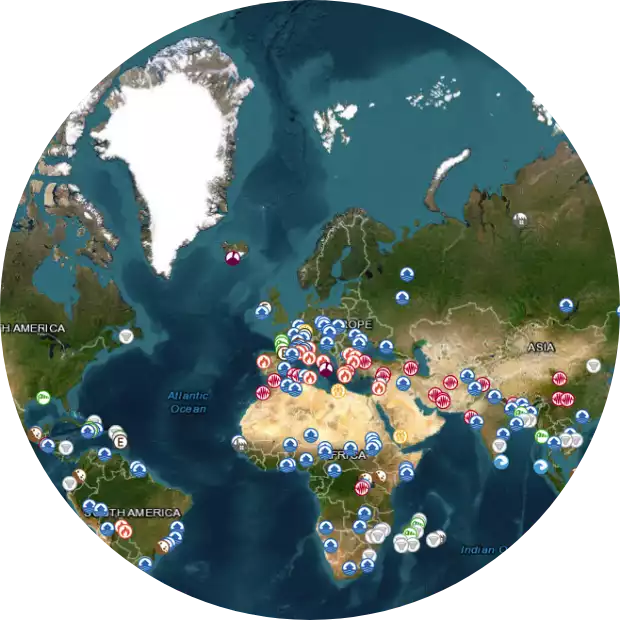
Right now on our planet…
- Protected: Implementation of a methodology combining 2D hydraulic modelling and satellite imagery to define the maximum flooded area and submersion depths
- 2025 Myanmar Earthquake as seen by Sentinel-1
- INterpolated FLOod Surface (INFLOS), a Rapid and Operational Tool to Estimate Flood Depths from Earth Observation Data for Emergency Management
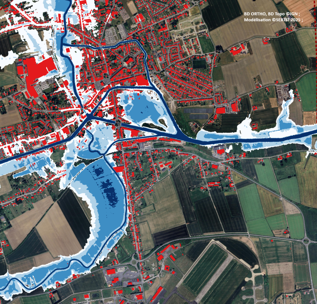
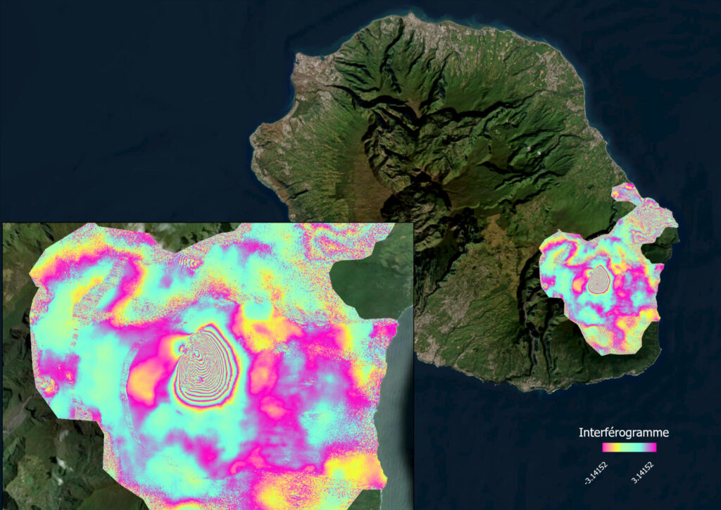
The Icube-SERTIT rapid mapping module
A world-renowned emergency information service

ICube Sertit’s fast cartography service is an emergency response to the information needs of those involved in risk management, crisis management and disaster reconstruction.
This ISO 9001-certified service is operational 24/7/365.
