In the context of flood emergency mapping for the Copernicus Emergency Management Service – Rapid Mapping (CEMS RM), the SERTIT Rapid Mapping Team has developed a tool for a rapid estimation of flood depth: (INterpolated FLOod Surface) delivers flood depth estimates in under 30 minutes, empowering civil security services with information to better understand the crisis.
How does it work?
(INterpolated FLOod Surface) delivers flood depth estimates in under 30 minutes, empowering civil security services with information to better understand the crisis.
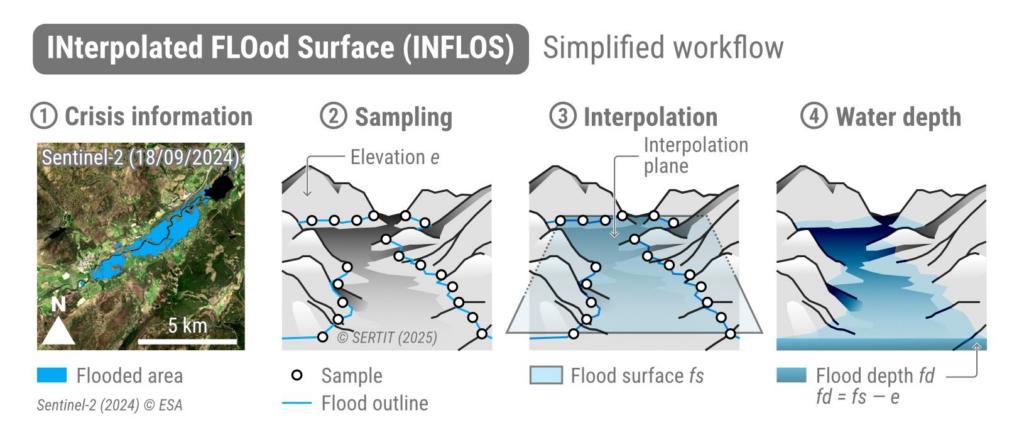
INFLOS provides an estimation of the depth distribution corresponding to flooded areas derived from notably satellite Earth Observation imagery. It calculates flood depth by interpolating water surface elevation from sample point altitudes along the flooded area’s boundaries (steps 2-3 in Figure1). An assumption is made that flood depth at the edges of flooded areas can be approximated as zero, as described by the formula 𝑓𝑑≈0⇔𝑒≈𝑓𝑠, where:
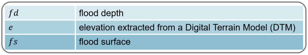
Flood depth can then be determined by subtracting elevation data from the flood surface. Consequently, 𝑓𝑑≈𝑒-𝑓𝑠 (step 4 in Figure1); negative values of 𝑓𝑑 correspond to areas unaffected by the flood and are located outside the boundaries of the observed event layer.
An example of results?
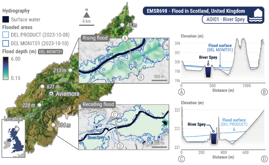
Figure2 shows an example of water depth distribution resulting from INFLOS algorithm. The upstream and downstream sections with rising and receding floodwater along the River Spey in Scotland are shown: the DEL PRODUCT (8 October 2023) and DEL MONIT01 (10 October 2023) flooded areas were delineated from Sentinel-1 (20 m) imagery. On the right hand side of the figure, some cross sections of the interpolated flood surface illustrate how the inundation progressed downstream between satellite acquisitions.
Why does it matter?
INFLOS has already been successfully deployed in over 40 CEMS RM activations and supported the production of hundreds of flood-related products. The full collection of the flood depth products is available on the CEMS RM official portal : https://mapping.emergency.copernicus.eu
Additional information about INFLOS can be found in the related paper: https://www.mdpi.com/2072-4292/17/2/329