Our intern Vitória has worked this summer to improve our fire detection algorithm based on Sentinel-2 data exploitation. The accuracy assessment performed on 12 test sites all over the world (Europe, Africa, South America and Oceania) indicates a real step forward in the thematic quality of the burnt areas detected. Thanks to her new insights, our automatic fire detection algorithm is now more robust and reliable on various kind of landscapes.
The algorithm is change detection driven and based on several indexes, such as Normalized Burnt Ratio (NBR), Burn Area Index (BAI), Burn Area Index for Sentinel-2 (BAIS2) and Normalized Difference Vegetation Index (NDVI) computed thanks to EOReader and developed in a Jupyter Notebook.
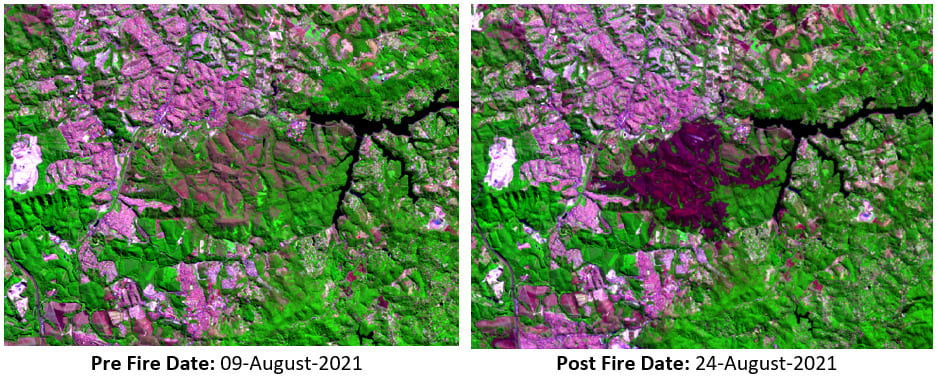
The fire season was terrible again this year. The Copernicus Emergency Service Rapid Mapping was activated 24 times for fire events this summer! Other regions were also affected by fire. This is the case of Juquery State Park in Franco da Rocha, in the metropolitan region of Sao Paulo – Brazil. The fire event is major and grave as more than half of the State Park burnt this late August.
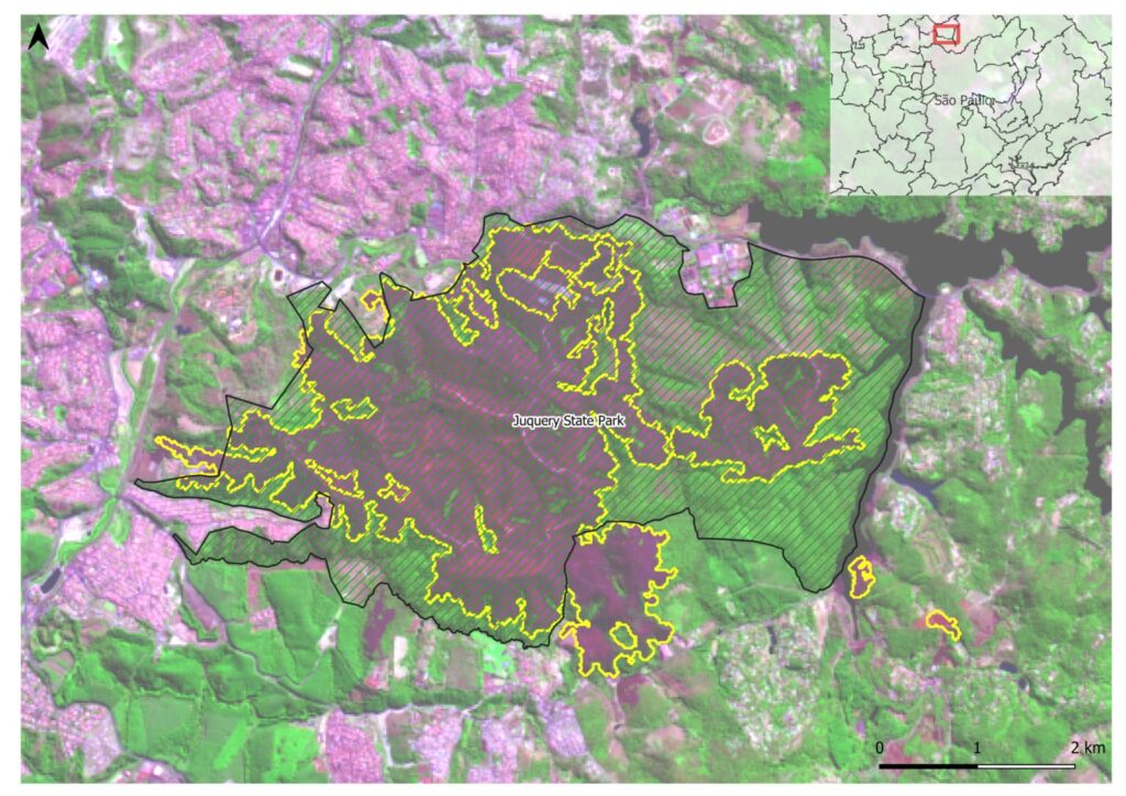
The Juquery State Park created in 1993 preserves the last remants of cerrado in the metropolitan region of Sao Paulo, covering an area of approximately 2.000 hectares. The park is just 50 km from the city of Sao Paulo and near the indigenous community Tekoha Itakupe. The local press reports that over 1100ha of the Park was damaged by the fire. The figures below show images pre and post fire (actual fire date: 22-August-2021).
The total burnt area identified by the algorithm is 1215.42 ha from each approximately 1079.52 ha belongs to the Juquery State Park.
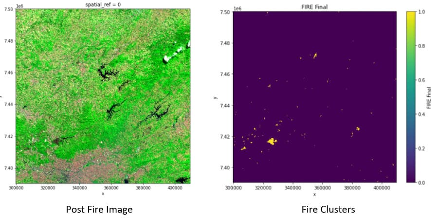
Apart from the burnt scar in the Juquery State Park fire, several smaller burnt scars were identified over the Sentinel – 2 image (tileT23KLQ) as shown on the image bellow. Visual inspection over the fire clusters has shown the majority of them correspond to true fire extent. However, some of these fire clusters are false positives, usually associated with harvest events.