Context
The Kakhovka hydroelectric dam in northern Ukraine has been the target of attacks, causing it to burst on 6 June 2023. Unprecedented flooding hit towns and villages as far downstream as the mouth of the Dnieper, forcing thousands of people to quickly evacuate. As well as producing electricity and supplying drinking water, the dam was used to irrigate the surrounding agricultural areas. Several irrigation canals have been disconnected as a result of the massive loss of water from the basin, depriving many of the region’s agricultural plots of water and impacting future harvests, posing a threat to food security.
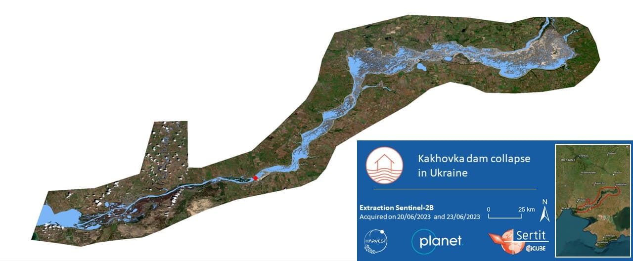
The figures below show the evolution of the situation following the dam burst, seen by satellite images. The dam is represented by a red dot.
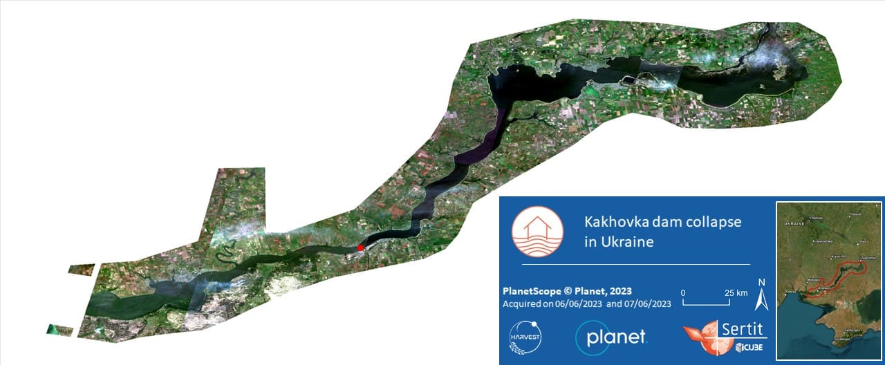
Situation before and during the flood
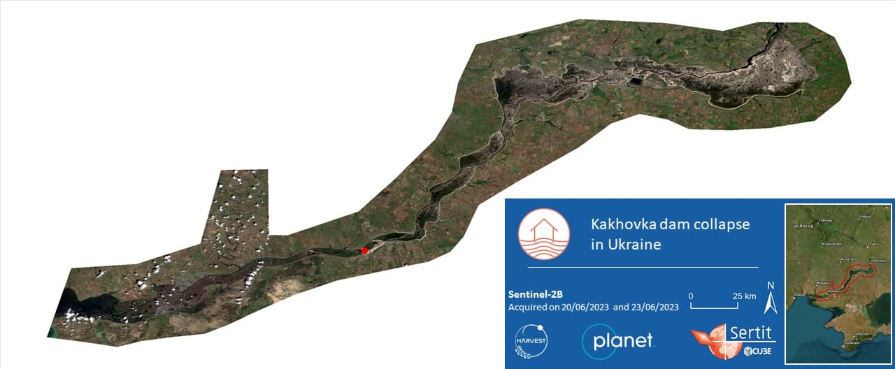
Situation during and after the flood
Situation before and after the flood
The contribution of satellite images
As part of the NASA Harvest program, SERTIT‘s rapid mapping service worked in collaboration with the RAAPS (Rapid Agricultural Assessments for Policy Support) team from the ICube-TRIO laboratory. SERTIT used satellite images with very different spatial resolutions (Sentinel-3: 300m, Sentinel-2: 10m and PlanetScope: 3m) to monitor the evolution of the flooding downstream and the disappearance of the water reserve upstream at different scales, day after day.
This work was carried out as quickly as possible in this crisis context, to provide information on the emptying of the dam and its impact to the Ukrainian civil security services and Ministry of Agriculture, as well as to humanitarian aid groups.
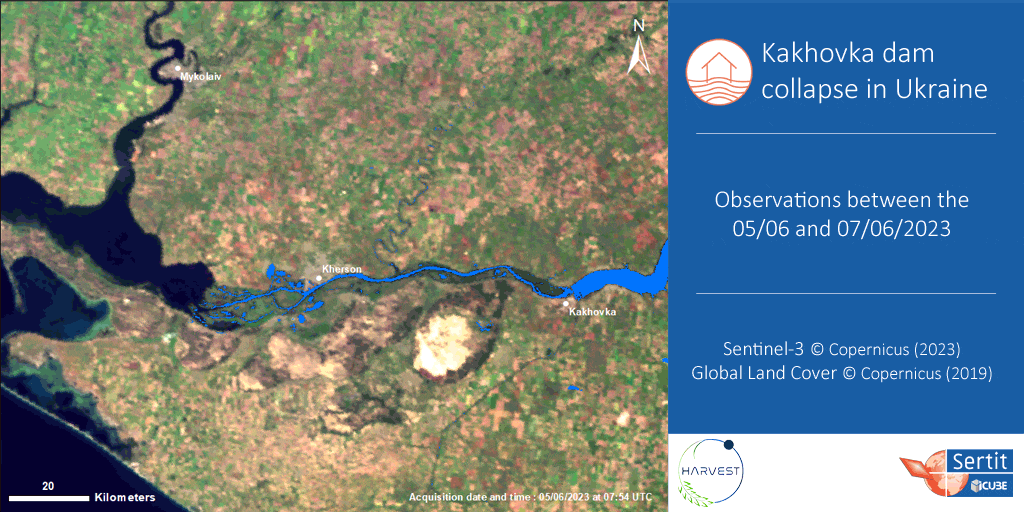
The combined use of these different optical satellite images enabled a precise study of the impact of the dam collapse. The favourable weather conditions made it possible to use optical images, enabling much more precise analyses, particularly in urban areas. The Sentinel-3 satellites provide one image per day, allowing very frequent temporal monitoring for a rapid but approximate estimate of the damage. PlanetScope data is also available on a daily basis, with very high spatial resolution, providing a more accurate estimate of the extent of the damage. However, the PlanetScope data does not cover the entire study area every day and therefore needed to be supplemented in order to obtain an accurate result. Therefore, Sentinel-2 data was used to complete and validate the results obtained.
Extraction of water from Sentinel-3 and PlanetScope
Extracting flooded areas
The purpose of extracting the areas of water was to delimit the extent of the flooding and thus help assess the damage in the area. It was carried out automatically and quickly using SERTIT’s ExtractEO tool, an end-to-end pipeline creation tool created for rapid mapping and specific to SERTIT. This tool enables users to process a wide range of satellite and radar images as soon as they are downloaded, without having to worry about the different characteristics of the many existing sensors. The sensors were managed using the EOReader open source Python library, which manages satellite sensors agnostically, enabling the same water detection algorithm to be used regardless of the sensor used.
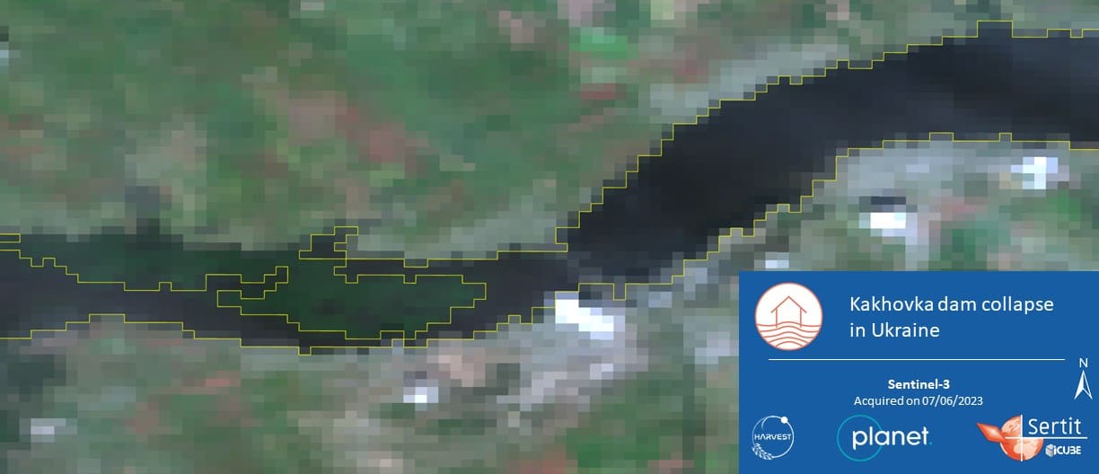
The animation below shows the various extractions made between 5 and 7 June, demonstrating the rapid spread of water downstream of the destroyed dam.
Monitoring of the water reserve surface upstream of the dam lasted until 20 June 2023. This result highlights the extent of the damage caused by the flooding, the considerable loss of water and the disconnection of many irrigation canals previously connected to the reservoir.
Extraction of water surfaces on 20 June 2023