FLORIA, a tool designed to identify urban flooding based on radar imagery
Floods are amongst the most frequent and damaging disasters globally. When a flood occurs in urban areas, risks are even higher because of the density of residents, buildings and infrastructure.
Being less sensitive to atmospheric conditions than optical images, radar imagery has the advantage of being able to penetrate most clouds, that often accompany flooding. To map urban floods accurately, SERTIT’s team offers a solution in the form of a specific tool: FLORIA (FLOodwater detection over urban areas using Radar and artificIAl intelligence). This tool is based on radar imagery and recent researches on the topic, such as Chini et al. (2019). It only requires three images to function: two acquired before the flood and one during the flood, called the “crisis image”.
Visualization of the urban flood in the oblast of Kherson in fake colors
The urban flood can be visualized in fake colors based on the information. This visualization is an RGB (Red Green Blue) composition proposed by Li et al. (2019). The composition will not be described here, but what is important to remember is:
- Flooded urban pixels can be seen in yellow
- Non flooded urban pixels can be seen in white
- Permanent bodies of water appear dark, almost black
- Non flooded non-urban pixels appear in red
- Flooded non-urban pixels appear in green
The GIF below presents the evolution of the water inside the cities of the oblast of Kherson between 6 and 9 June 2023.
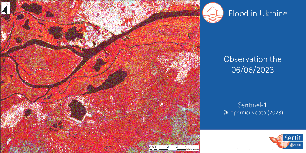
Using the image acquired on 6 June as the crisis image, a little water can be seen inside the city of Kherson. This is easily explained by the fact that the dam breakage occurred at 2:20 AM (local time), only 5 hours prior to the acquisition of the radar product at 7:05 AM (local time), so flood water had not reached the cities yet. However, by using the image acquired on 9 June as the crisis image, the flood extent in urban areas is visible, especially in the city of Kherson.
Results of the extraction of the urban flood extent using FLORIA
The three Sentinel-1 products used for the extraction with FLORIA were acquired on:
- 16 May 2023 at 15:36:55 UTC
- 28 May 2023 at 15:36:56 UTC
- 9 June 2023 at 15:36:56 UTC
The result of the extraction is visible on top of Planet imagery acquired the same day, on 9 June 2023.
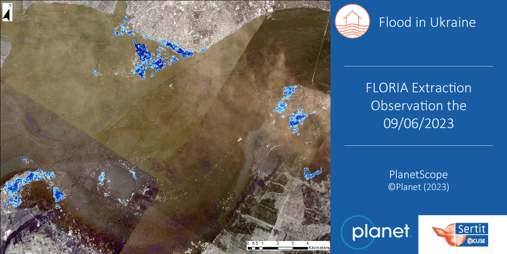
Extraction des inondations urbaines le 9 juin 2023
Looking at the Planet image, the extraction obtained with FLORIA seems to be quite accurate to the reality of the urban flood, especially in the city of Kherson, at the top of the image.
Comparison of the results obtained through FLORIA with the non-urban flood extent
SERTIT’s Rapid Mapping team had the opportunity to work with the RAAPS (Rapid Agricultural Assessments for Policy Support) team from the ICube-TRIO laboratory, as part of the NASA Harvest program to monitor the evolution of the flooding in Ukraine. This work resulted in several extractions thanks to the ExtractEO tool, also developed by SERTIT. One of them is visible alongside the FLORIA extraction of the illustration below.
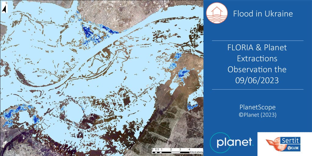
Extraction globale de l’inondation lors de la rupture du barrage de Kakhovka en Ukraine
Again, the extraction obtained with FLORIA seems to fit quite well with the global flood extent. In the future, there is hope that FLORIA will be able to complete any type of flood extraction, no matter the place, by being able to detect flooded urban areas.
References
Chini, M., Pelich, R., Pulvirenti, L., Pierdicca, N., Hostache, R. and Matgen, P. (2019) Sentinel-1 InSAR Coherence to Detect Floodwater in Urban Areas: Houston and Hurricane Harvey as A Test Case, Remote Sensing, 112, p. 107. [https://doi.org/10.3390/rs11020107].
Li, Y., Martinis, S., Wieland, M., Schlaffer, S. and Natsuaki, R. (2019) Urban Flood Mapping Using SAR Intensity and Interferometric Coherence via Bayesian Network Fusion, Remote Sensing, 1119, p. 2231. [https://doi.org/10.3390/rs11192231].