Nearly three months ago, SERTIT had the pleasure to participate in ESA’s Living Planet Symposium in Vienna, Austria, from the 23rd to the 27th of June 2025. As the slides are now available online, we are pleased to share with you a small overview of our presence at the Symposium.
It has been an intense week, filled with interesting insights regarding Earth Observation and its diverse applications. The diversity of actors present at the event enabled the opportunity to have some very interesting exchanges on the Earth Observation domain, and we are glad to have had the opportunity to be a part of this symposium. The exchanges that resulted from this Symposium are really fruitful.
This has also been an opportunity for SERTIT to present some of our ongoing work. Aside from our contribution to the well-presented Copernicus Emergency Management Service (CEMS), our posters and presentation offered a deeper insight in our expertise domains.
SWOT Advances in Hydrological Monitoring
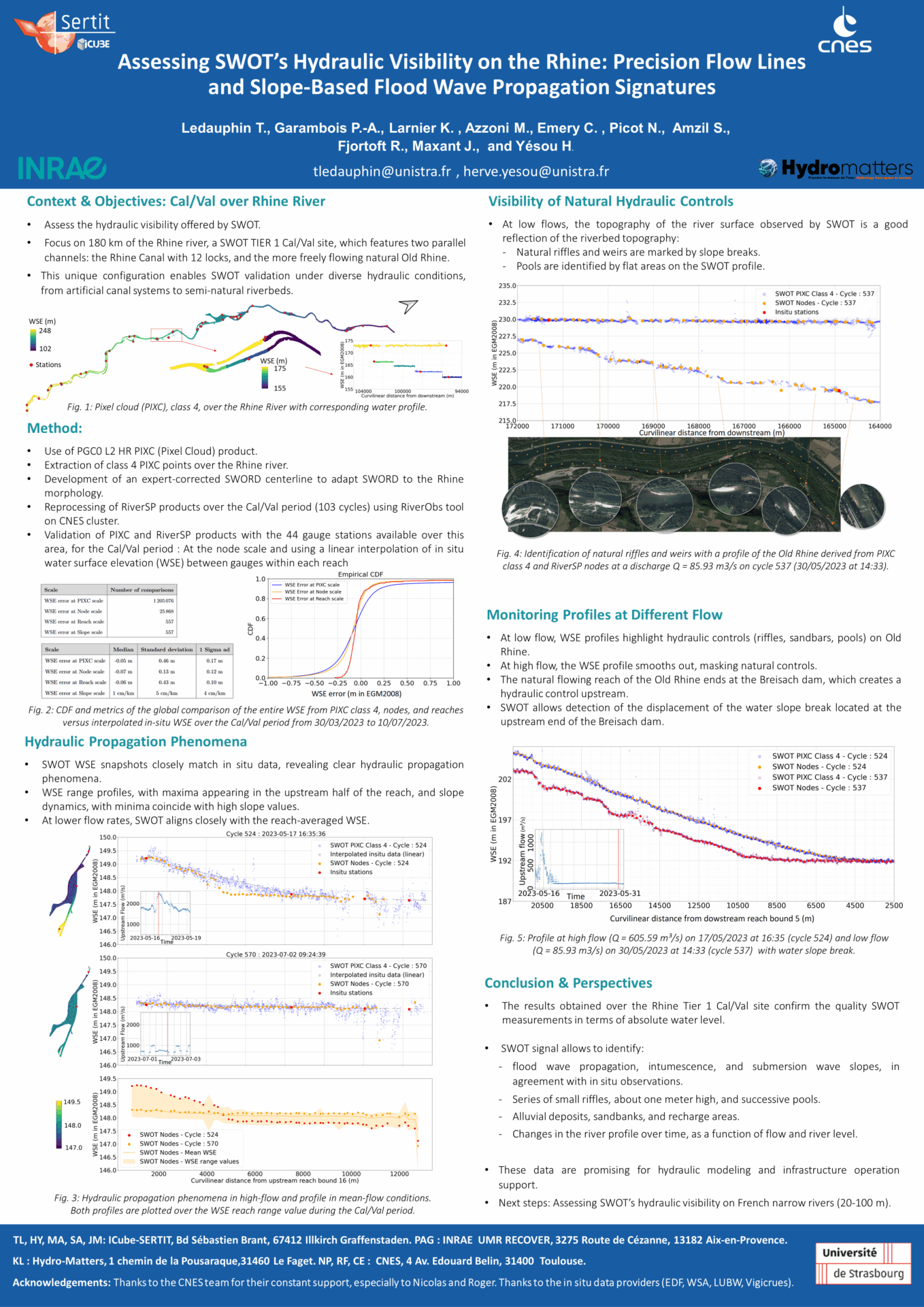
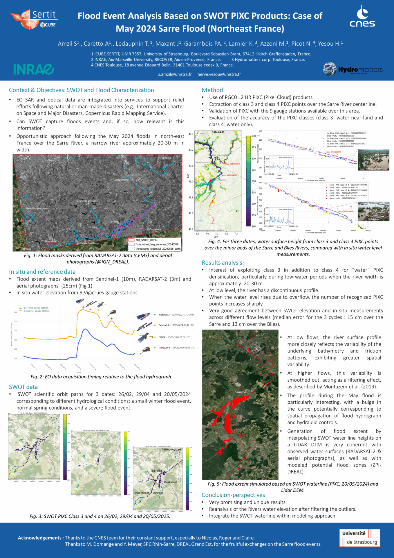
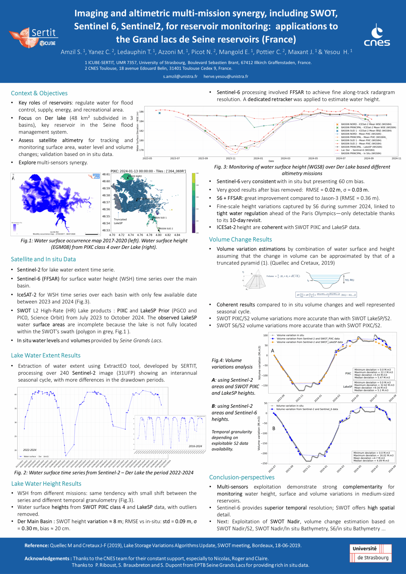
Three complementary studies highlighted the unique potential of the SWOT mission for hydrological monitoring. The first demonstrated SWOT’s remarkable ability to capture detailed water surface elevation and slope profiles along the Rhine, enabling the detection of fine hydraulic phenomena even under extreme conditions. The second showcased SWOT’s contribution to flood mapping and hazard assessment by providing unprecedented water level data, crucial for evaluating flood danger beyond simple extent mapping. The third study focused on monitoring water levels and surface variations in reservoirs, illustrated on France’s Lac du Der, demonstrating the value of combining SWOT and Sentinel-6 data for precise water stock management. Together, these results confirm SWOT’s strong potential to enhance river monitoring, flood response, and water resource management globally.
Session: A.08.01 – POSTER – Advances in Swath Altimetry
Poster titles:
– SWOT hydraulic visibility on a densely instrumented reach of the Rhine canal: accurate flow lines and wave propagation signature
– Imaging and altimetric multi-mission synergy, including SWOT, Sentinel 6, Sentinel2, for reservoir monitoring: applications to the Grand lacs de Seine reservoirs (France)
– Flood event analysis based on SWOT PICX products: case of May 2024 Sarre (Northeast France) and October 2024 Valencia Province (Spain) floods events
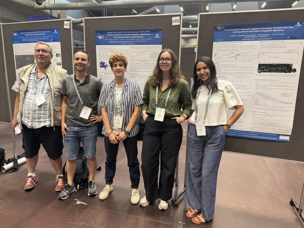
Presenter: Sabrine AMZIL and Hervé YESOU
Wind disasters and 3D assessment
The goal of this presentation was to showcase an innovative methodology to detect damages from extreme wind events. Indeed, extreme wind events such as thunderstorms, tornadoes, hurricanes, typhoons, etc. can be responsible for disasters in terms of human lives, but also in terms of assets. Our methodology is based on the use of Very High Resolution (VHR) stereoscopic satellite images to generate Digital Surface Models (DSM) before and after the event, and compare them to detect the areas that were damaged. The results are very encouraging, showing that damages on both infrastructures and vegetated areas can be detected.
Session: F.02.03 Using satellite EO in global capabilities for disaster response
Presentation title: Development of Innovative 3D Based Damage Assessment Products for Insurance Market Sector Applications in Case of Extreme Wind Events
Presenter: Zoé PAPIRER
Slides are available here: https://lps25.esa.int/lps25-presentations/presentations/924/
Wildfire and thermal/3D assessment
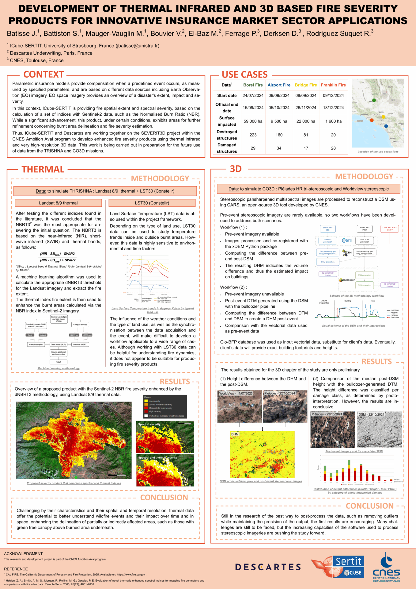
The presented poster showed some preliminary results developed in the framework of a CNES Ambition Aval project, in order to prepare the uses of TRISHNA and CO3D mission data. ICube-SERTIT and Descartes Underwriting (new generation global corporate insurer) are now working together on the SEVERIT3D project to develop enhanced fire severity products using thermal infrared and very high-resolution 3D data. Using Landsat imagery, Constellr’s LST30 product and VHR stereoscopic data, a workflow was developed based on the state of the art. The first results are encouraging and showing the potential of such methodologies to go further than the uses of spectral indexes.
Session: B.04.06 – POSTER – Fire Detection and Monitoring from Earth Observation Data for Rapid Disaster Response
Poster title: Development of Thermal Infrared and 3D Based Fire Severity Products for Innovative Insurance Market Sector Applications
Presenter: Jules BATISSE
Don’t hesitate to contact us to learn more about our products.