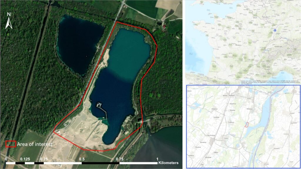
In the frame of the study of the dynamics of water bodies in the Grand-Est region (France), the water surface time series for the gravel pit in Nordhouse (next to the Plan d’Eau de Plobsheim) has been produced.
This was made possible through the use of the ExtractEO processing chain. The accuracy of the analysis allows the water to be extracted from the high-resolution Sentinel-2 images, so that the water surface time series was retrieved over an interval of about 5 years, from 2017 to early 2022.
As it can be observed by the plot in Figure 2, the water surface has been expanding since 2017, proof that ongoing activities have enlarged the size of the quarry.
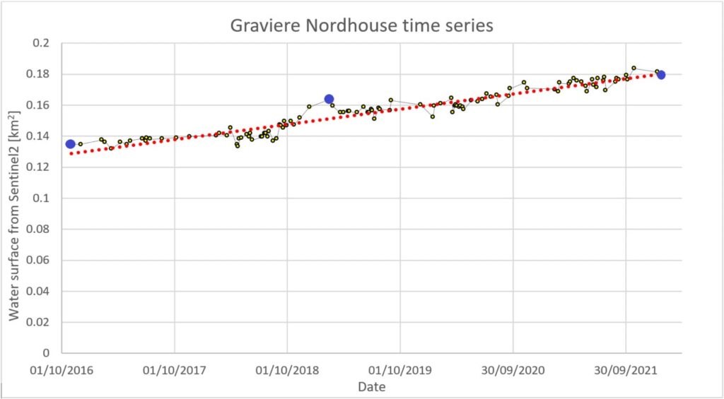
In particular, three values of water area are reported in the following table, related to three dates (marked with blue points in Figure 2) respectively at the beginning, the middle and the end of the observing period:
| Date | Water surface [km2] |
| 01/11/2016 | 0.135 |
| 14/02/2019 | 0.164 |
| 24/01/2022 | 0.179 |
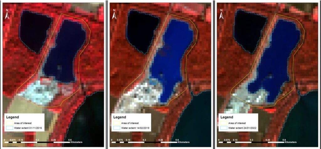
The three images in Figure 3 show the water extraction contour (blue line) in correspondence of the AOI of the pit (yellow line) for the three above mentioned dates:
It can be observed that ExtractEO has successfully detected the extent of the water bodies and in particular the evolution of the water surface in the pit is closely followed during the approximately five years.