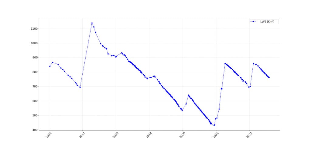
Lake Water Extents derived from Sentinel-2 time series, ICube-SERTIT
As part of the CCI Lakes project, ExtractEO, an automatic water detection workflow developed by ICube-SERTIT, was applied to the full Sentinel-2 time series covering Lake Argyle, Australia, from January 2016 to August 2022, deriving a lake mask for each Sentinel-2 acquisition date at 10m ground resolution.
The ExtractEO pipeline downloaded 800 Sentinel-2 images and detected water extents based on a Multi-Layer Perceptron (MLP) algorithm.
The lake surface is calculated for each date that was cloud-free over the lake. Then, the results are fed into the Lake Water Extent (LWE) curve.
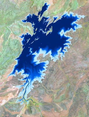
Occurrence products were also derived from lake water extents over the 5.5 years observation period and compared to the Global Surface Water database.
Comparing the LWE extracted from Sentinel-2 data and the water level (LWL) time series, calculated using satellite altimetry, a polynomial relationship LWE = f(LWL) has been established for this lake. Thus, LWL from altimetry can be related to LWE using hypsometry.