
Extraction of water surfaces over the Grand-Est with ExtractEO
27 September 2022
Water and its management are crucial issues, especially in times of climate change and biodiversity loss. In this context, water surfaces such as lakes are particularly interesting areas. Earth observation data is playing an important role in assessing and monitoring this resource. The scientific community, with the development of dedicated satellite missions such as SWOT or TRISHNA, is mobilizing to meet this challenge.
Water extraction
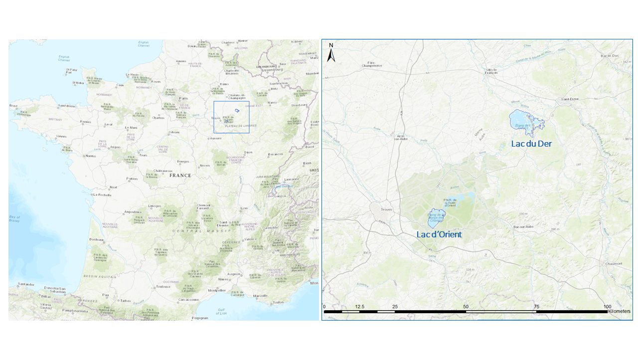
It is within this framework that our intern Alessandro Caretto has been working for six months to define a procedure for processing high-resolution Sentinel-2 data to study the dynamics of water bodies in the Grand-Est region, France, on a range of around 5 years, from 2017 to 2021. As starting point, the water extraction parameterization has been successfully applied and validated on two of the “Grands Lacs de Seine”, Lac du Der and Lac d’Orient (Fig.1). In Figure 2 it is displayed the time series for Lac du Der fully automatically extracted from the satellite images (blue curve) and the reference value (tailored reference, process one by one image and validated exploiting VHR Pleiades imagery).

The processing chain ExtractEO, developed by our Deputy Head of Software Development Rémi Braun, has been put into play for the purpose. By calibrating the several parameters involved in the processing for the water extraction, a common set has been selected toward a more generalized, and so potentially more easily transferable, procedure. The pixel classification is done by training a Multi-Layer Perceptron model over each Sentinel-2 tiles. The samples are retrieved from a water database thanks to several parameters. A contextual yet critical parameter is based on the thresholding of NDWI (Normalized Difference Water Index), whose range has been characterized as follows:
| Non-Water Samples | Uncertainty Buffer | Water Samples |
|---|---|---|
| NDWI ≤ -0.1 | 0.1 < NDWI < 0.3 | NDWI ≥ 0.3 |
Managing outliers with custom spectral index
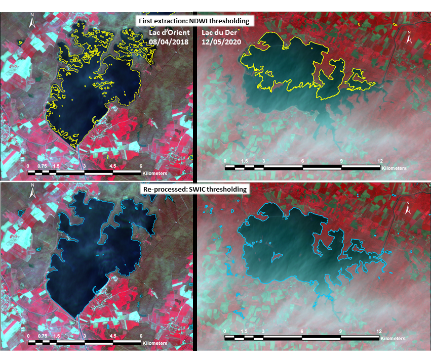
Nevertheless, in the case of presence, above the lakes, of cirrus or shadows due to the clouds, the thresholding value common to all the tiles and the dates of the Sentinel-2 images, has shown some limitations, the NDWI being very sensitive to perturbations. In those cases, thanks to Alessandro’s initiative, the water extraction has been improved by the introduction of a new indices combination, later referred to as SWIC (Specific Water Indices Combination), which consists of a custom combination of spectral indices and bands:
NDWI+MNDWI -GREEN
The power of this new approach lays in the fact that the indices combination highlights the difference between water and non-water samples, characterized by a SWIC value respectively greater and lower than zero. So a value SWIC = 0 has been used to re-process the images for which the water extraction was not successful. Some images for which the SWIC parameter has been successfully applied ca be seen in the following picture:
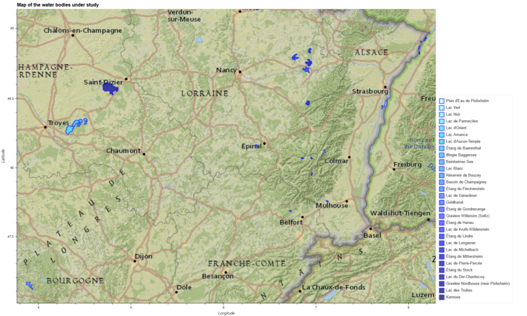
The procedure has then been extended to study the water surface variation of a total of 30 water bodies, with diverse variety of scenarios where to test the above described approach. The map in Figure 4 provides an overview of the lakes and ponds under study.
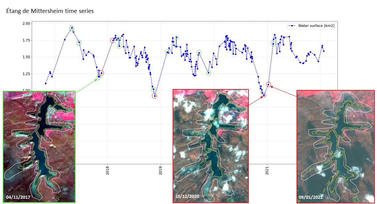
Managing irregular trends
To overcome the challenges in the interpretation of irregular trends in the time series (as in the case of the Étang de Mittersheim in Figure 5), a graphical interface (see the video here below) has been developed for the fast visualization of the images corresponding to the points in the time series. This could eventually allow to spot the outliers and to further refine the time series.
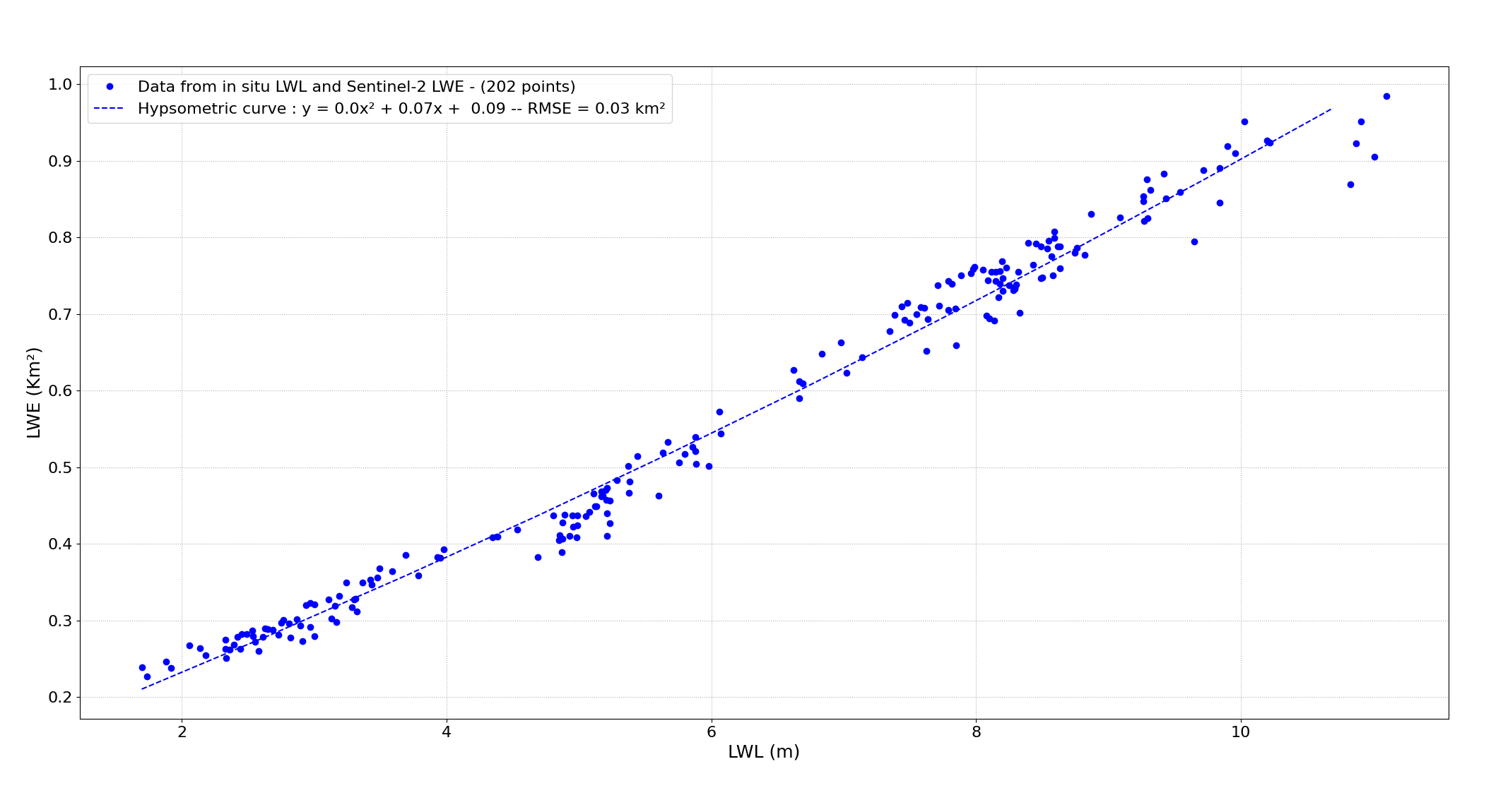
Furthermore, the values of water surface extent, extracted from the Sentinel-2 images has been plotted versus the in-situ values of water level (when available) for the respective dates, in order to assess the consistency of the trend, represented by the hypsometric curves such as the one in Figure 6.
Soon after the mission launch, 5th December 2022, the derived open water surfaces will be exploited to validate the SWOT water surface products.
Demonstration of the script developped by Alessandro and used to investiguate the correcteness of water extractions